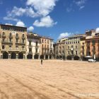
Spain is crisscrossed by a network of long-distance hiking trails called Senderos de Gran Recorrido, or GR footpaths. These trails usually take anywhere from a few days to several weeks to complete, making them ideal for hikers seeking a multi-day trek.
This post describes a five-day hike that combines the most scenic sections of two of these trails to connect the towns of Vic and Besalú, both of which are easy to reach by public transport from Barcelona.
The route takes you through some of the most beautiful scenery in Catalonia, including the Collsacabra mountain range, La Vall d’en Bas, and the Garrotxa Volcanic Zone. Along the way, you hike through tree-covered mountains and green valleys and stop at tiny medieval villages, which are a testament to the area’s rich history.
If you’re visiting Barcelona and fancy spending a few days hiking in the mountains, this guide contains everything you need to know to tackle the route.
I’ve included info about the trail, plus transport and finding accommodation. I’ve tried to make the post as comprehensive as possible, but if there’s anything else you need to know, feel free to contact me using the comment section at the end of the post.
Hiking from Vic to Besalú
The route
The majority of this hike follows stages four to eight of the GR 2 long-distance hiking trail, which runs from the French border to Sant Adria de Besós on the outskirts of Barcelona.
Although the stages of the GR 2 are numbered from north to south, this five-day hike starts in Vic and heads northwards to Besalú. This is because there are early morning trains from Barcelona to Vic, allowing you to start early and have plenty of time to complete the first stage.
There’s more information about transportation later in the post.
From Vic to Vilanova de Sau, the route follows the GR 151, which is also known as the Camí Oliba, and runs from Montserrat to the Pyrenees. Starting in front of Vic Cathedral, it takes about thirty minutes to walk from the centre of Vic to the surrounding countryside. There are very few way markers on this section, so I recommend you follow the Wikiloc trail linked in the table above.
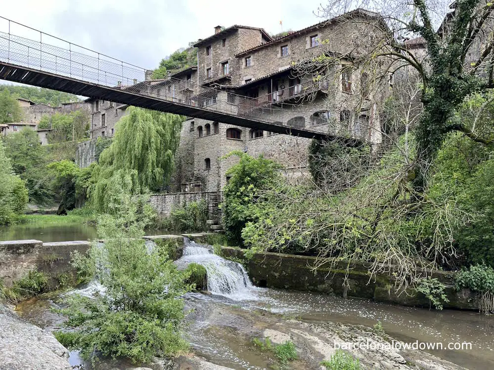
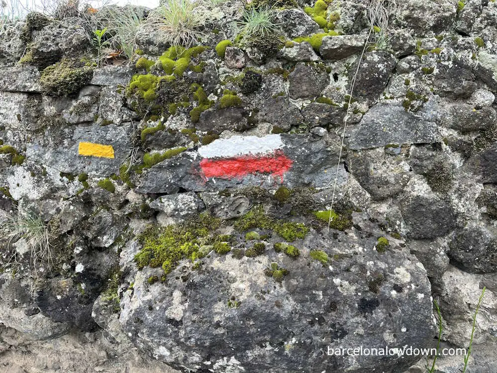
Shortly after leaving the city’s outskirts, you cross a medieval bridge called el Pont d’en Bruger. From here, you follow a marked footpath called la Ruta dels Molins, a popular route from Vic to the village of Sant Julia de Vilatorta. Here, we join the GR 2 footpath, which is well-marked with white and red trail markers (see below).
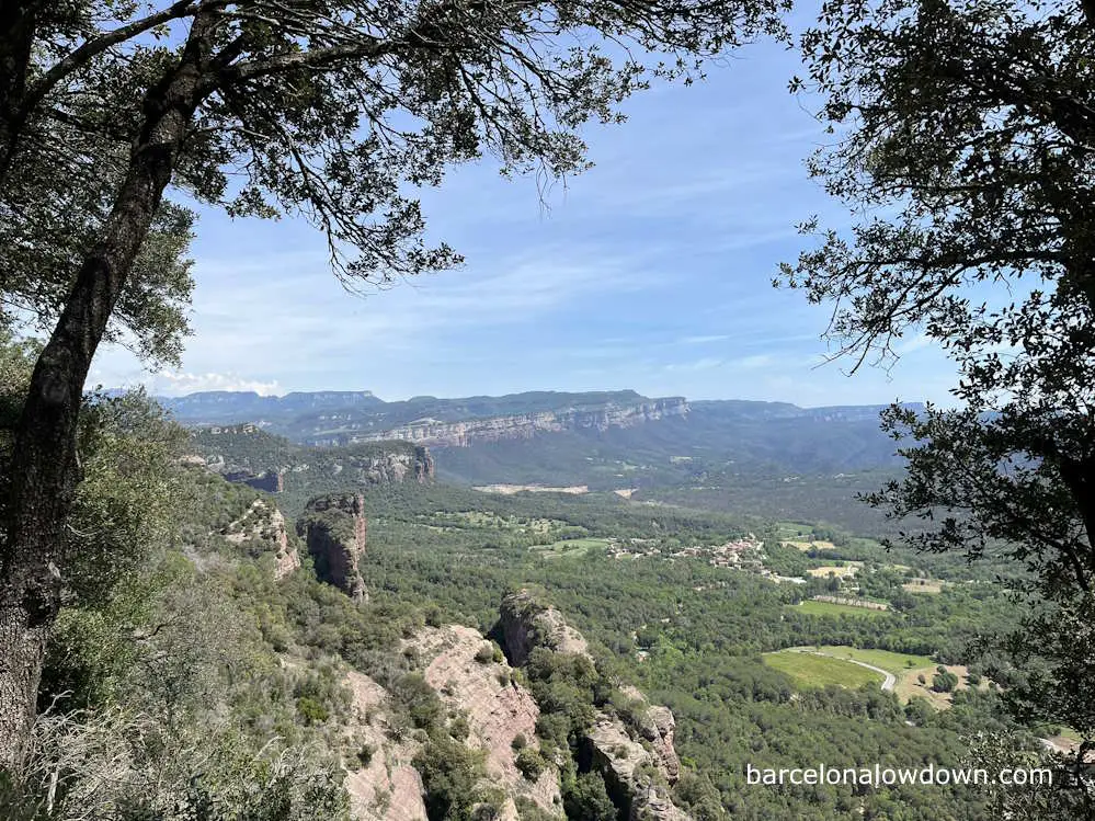
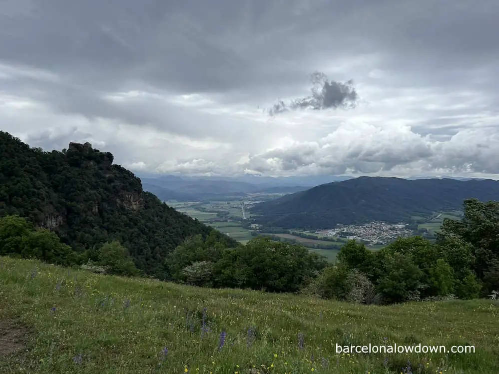
From here, we begin our slow ascent across the plains of Vic, past the castle of Sant Lloreç del Munt to el Salt de la Minyona, which affords spectacular views across the Sau Valley to the Collsacabra mounting range, where we are going to be hiking for the next couple of days.
The rest of the first day, we continue downhill through woods towards Vilanove de Sau. Along the way, we encounter numerous panoramic viewpoints with views of the valley and the cliffs up ahead.
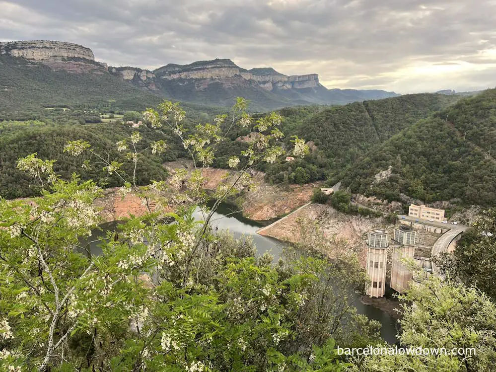
After spending the night in Vilanova de Sau, we continue through the woods to the Panta de Sau reservoir. The reservoir was created in the nineteen sixties, when a dam was built, flooding the valley and the town of Sant Romà de Sau, whose medieval church has been on the news recently since it has become uncovered during the current water shortage.
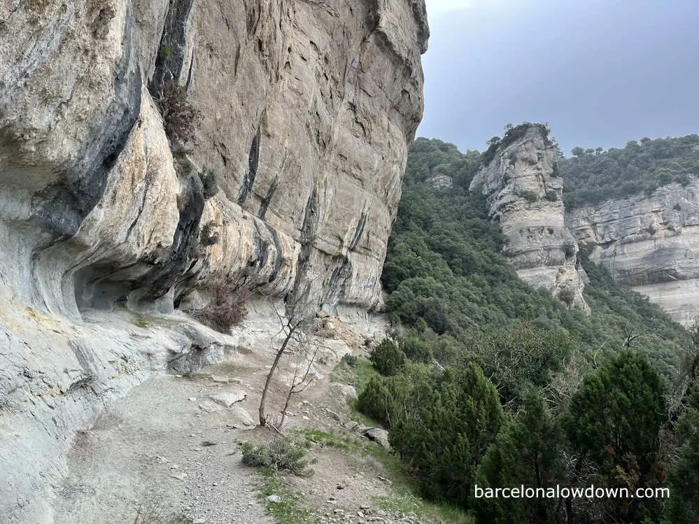
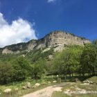
After crossing the dam, the path heads uphill to the tiny medieval village of Tavertet and onwards to Rupit, along the top of the Cliffs of Tavertet, where we ascend to the maximum altitude of this route at 1,089m. The views along this section are usually spectacular, although when I walked the route in the spring of 2024, I was unlucky with the weather: it was raining heavily and cloudy.
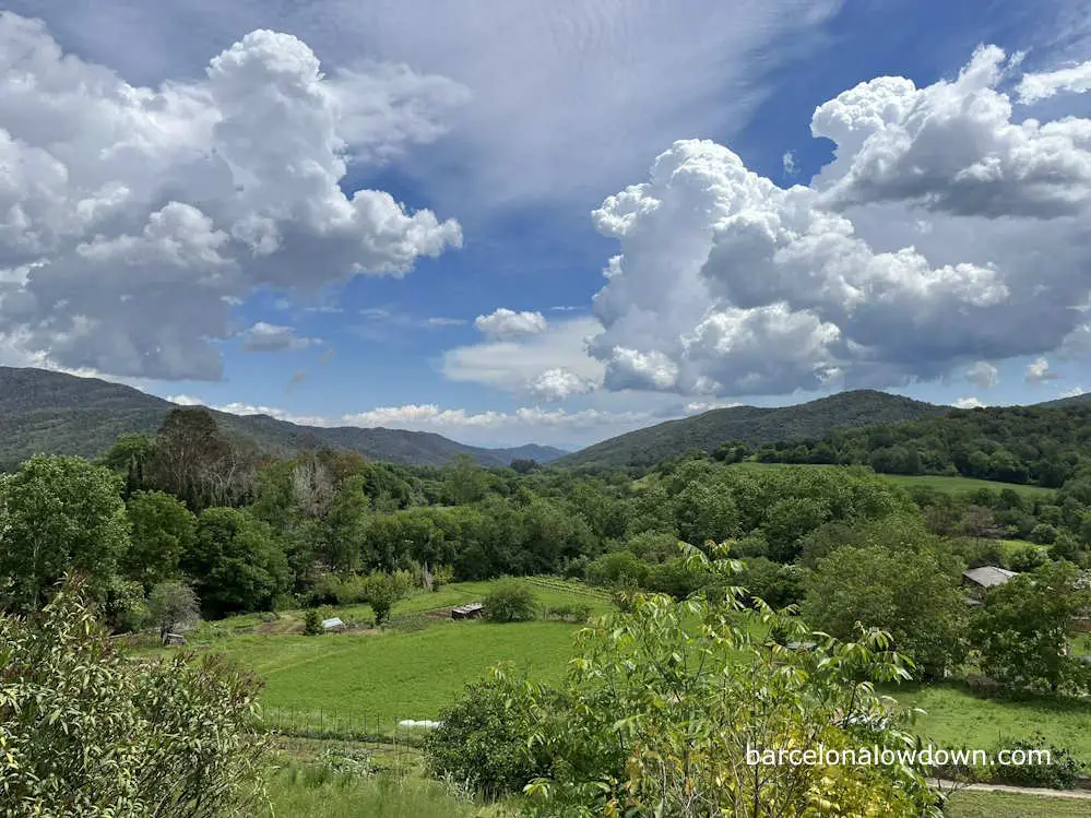
From Rupit, we continue upwards, past the village of Pruit to the Coll de Pruit, and then onwards, through a mixture of farms and woodland before our descent into the Vall d’en Bas, one of the most beautiful areas of Catalonia.
We then hike along the valley floor to the town of Les Preses, where we spend the night. Alternatively, you could continue to Olot, although this would add an additional 4km to days three and four.
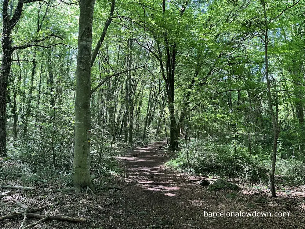
Shortly after leaving Les Preses, we enter the La Garrotxa Volcanic Zone, an area of extinct volcanoes that last erupted more than eleven thousand years ago. We start the day by ascending Puig Rodó, after which we pass several ancient hermitages before entering the Fageda d’en Jorda beech forest.
The Fageda d’en Jorda is a popular area for hiking, and you will see lots of footpaths with signposts indicating routes through the forest to different volcanoes, including el Volcà del Croscat and Volcà de Santa Margarida.
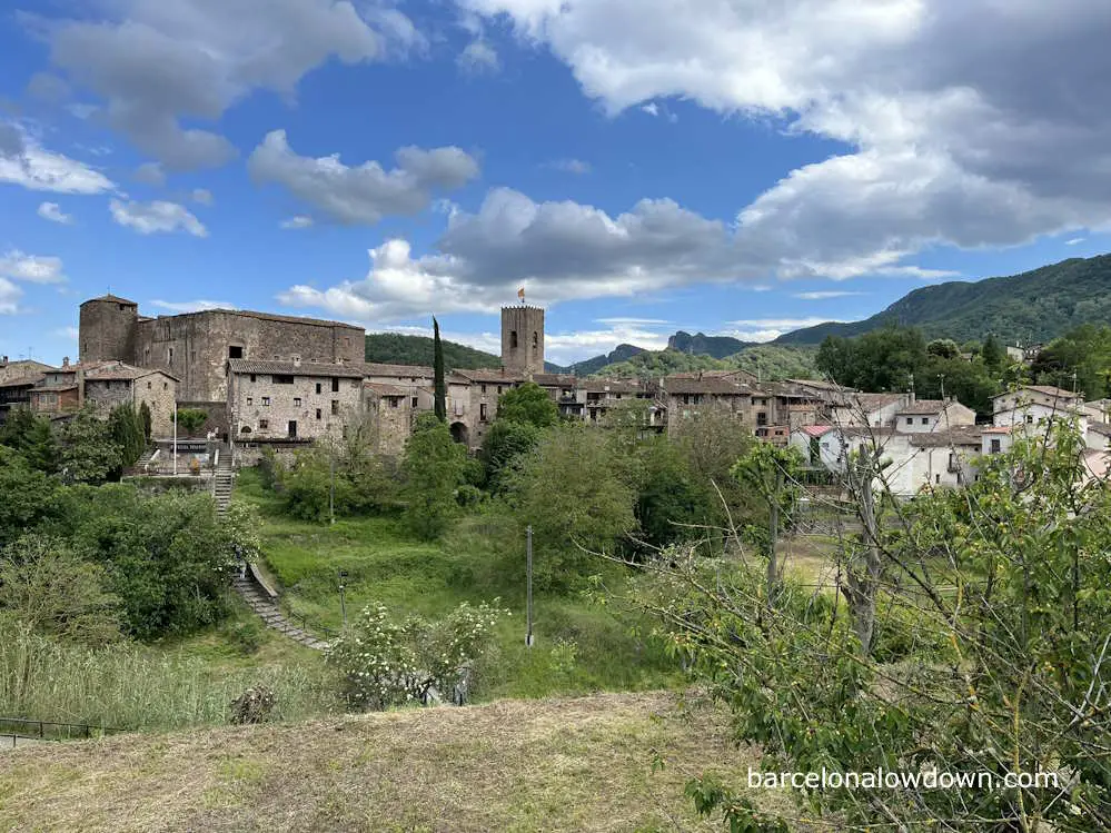
After about three and a half hours, we arrive at Santa Pau, a tiny medieval village built on a hill with a small castle and defensive walls. Although not as well known as Besalù, the village is quite touristy and has several hotels and restaurants, as well as a decent size supermarket in the modern part of the village.
From Santa Pau, we follow a country road through farmland towards Besalú. This whole area is commonly referred to as the pre-Pyrenees and is surrounded by mountains. Although almost half of this stage is on country roads, the lack of traffic and beautiful surroundings mean that it’s still a pleasant and enjoyable hike.
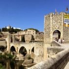
Along the way, you pass a couple of waterfalls and several interesting churches before ascending to the last mountain pass of the hike, El Coll de Salom. From here, we descend into the town of Besalú, which marks the end of the trail.
Besalú is an interesting medieval town with an impressive fortified bridge dating back to the eleventh century. It’s a good place to spend some time before catching the bus back to Barcelona. Buses also depart from here for Girona and Olot. For more information, check out my in-depth guide to Besalú.
What to expect
The route follows well-marked trails with an average distance of twenty kilometres per day.
Most of the time, you are hiking on a mixture of footpaths and woodland tracks, although there are some sections where you are hiking on country roads, although I encountered very little traffic when hiking during May 2024.
The hike takes you through mountains at altitudes generally between 400 and 1000 meters, similar to the Lake District National Park in the UK. There are no technical or especially exposed sections, and the route can be hiked throughout the year. However, it can be quite hot during the summer, and you may encounter snow during winter.
I would recommend this hike for most people, although you should be reasonably fit and have at least some previous hiking experience. The trek isn’t especially demanding, but there is very little public transport infrastructure along the trail after leaving Vic. This means you need to be confident in your ability to finish each stage.
If you have already completed a few longer day hikes, this would be a good choice as your first multi-day hike. If you’re a complete beginner, I recommend you check out my post about the Costa Brava Coastal Path.
Accommodation
There is accommodation available at the start and end point of all the satges, so there’s no need to carry a tent or camping equipment unless you want to. In the table below, I’ve listed the budget hotels and guest houses that I stayed at when walking the route in the spring of 2024.
The only village where I had problems finding suitable accommodation was Vilanova de Sau. There are two holiday cottages in the village, which would be a good choice for couples or groups, but work out expensive when travelling alone. Because of this, I decided to stay at Camping el Pont, which is a little over three kilometres from the village and has “bungalows” which cost €50 per person per night.
Unfortunately, since it was early in the season, the campsite shop and restaurant were both closed, so I had lunch in the village and brought food with me for the evening. If you’re interested, I’ve included the route to the campsite here.
There used to be a budget hotel near the Sau Reservoir, close to the trail, which would be an ideal place to stay, but unfortunately, it’s been closed since 2017. When I walked the route in 2024, it looked like the building was being renovated. I’ll update the post if the hotel reopens.
As I mentioned earlier, I decided not to stay in Vic or Besalú on this occasion and travelled directly from/to my home in Barcelona by public transport. However, both towns are well worth visiting, and I’ve included links to hotels I’ve stayed in and recommend in both towns.
| Location | Hotel |
| Vic | Hotel Estacio del Nord |
| Vilanova de Sau | Camping el Pont |
| Rupit | Casa Can Rufo |
| Les Preses | Hostal Vertisol |
| Santa Pau | Can Menció |
| Besalú | Els Jardins de la Martana |
Food and drink
Each of the stages ends at a small village with at least one or two restaurants or bars where you can get something to eat. However, you should check online when planning your trip because some restaurants don’t open on Monday or may not open in the evenings on some days, especially during the winter.
It’s also worth mentioning that most shops don’t open on Sundays in Spain, although bakeries are normally open on Sunday mornings. In smaller towns, many shops close for lunch from about 1:30 pm to 4 pm.
Les Preses and Santa Pau both have at least one medium-sized supermarket and one or more bakeries. Rupit has a small village shop and a bakery. Vilanova de Sau is very small, and although there are two restaurants, there isn’t a shop.
If you are camping and plan to cook for yourself, you should bring enough food for the first three days and then plan to stock up again in Les Preses.
Likewise, if you’re staying in hotels, it’s a good idea to bring two days’ worth of snacks and fruit with you from Barcelona or stock up in Vic before starting the hike.
Finding your way
The GR footpaths are marked with white and red waymarkers, as shown in the photo below. There are also signposts, and you will find plenty of trails on Wikiloc, including my trails, which I linked to in the table above.
Although the trails are very well marked, I recommend that you carry an up-to-date map. This can be a physical, paper map, an electronic map in the form of a GPS or an app on your phone.
Maps and guidebooks covering the area are available at the Altaïr bookshop in Barcelona.
Getting to and from the trail
Barcelona to Vic
The R3 regional train takes approximately ninety minutes to travel from Barcelona to Vic. There are departures every thirty minutes throughout the day. Timetables and prices here.
Besalú to Barcelona
Bus company TEISA operates four buses per day from Besalú to Barcelona. The journey takes two hours, and there are timetables here. Alternatively, you can take a bus from Besalú to Girona and then catch a bus or train from Girona to Barcelona.

Your guide is wonderful — Gracias! Do you have any other lodging suggestions for the night of Vilanova de Sau. My friend and I are looking for two beds on 21 May. Dinner and Breakfast would be nice too, but we can manage that if you don’t have other ideas.
Hi Laura,
Unfortunately I didn’t see your comment until now, ten days after your visit. Sorry!
I hope you enjoyed the hike, and would be interested to hear how you got on and where you stayed in Vilanova de Sau if you have time.