The Camins de Ronda are a series of historic footpaths that run along the Costa Brava, one of Spain’s most beautiful sections of coastline. The paths date back more than a thousand years and were originally used by fishermen to travel from village to village.
From the mid-nineteenth century, the paths were used by the police, who patrolled the coastline on the lookout for smugglers. Apparently, the name Camins de Ronda is a reference to these patrols.
Over the centuries, some of the original paths have fallen into disrepair or have disappeared completely due to erosion. The development of holiday resorts and the construction of private houses and apartments have also taken their toll in some areas.
More recently, the remaining sections of the paths have been restored and interconnected with other footpaths, and it is now possible to walk the entire length of the Costa Brava, from Blanes to Portbou, approximately two hundred and twenty-five kilometres in total.
If you’re thinking of hiking the Camins de Ronda, this post will provide you with all the information you need, whether you’re planning to walk a single section of the path or want to take on the entire route.
Contents
- Camins de Ronda or Costa Brava Coastal Path?
- Costa Brava Coastal Path stages
- What to expect when hiking the Costa Brava Coastal Path
- Guidebooks and planning
- Accommodation along the Costa Brava Coastal Path
- Food and drink
- Finding your way
- Getting to the Costa Brava Coastal Path from Barcelona
- Transferring between towns on the Costa Brava
- Best footwear for hiking the Costa Brava Coastal Path
- Camins de Ronda packing list
- Health centres, pharmacies and the emergency services
- Self-service laundries on the Costa Brava Coastal Path
- Helpful resources
- Tips & FAQs
Camins de Ronda or Costa Brava Coastal Path?
As mentioned earlier, some parts of the original Camins de Ronda no longer exist. Therefore, in order to walk the entire length of the Costa Brava, it is necessary to combine them with other long-distance trails such as the GR 92 and the GR 11. This combination of paths is commonly referred to as either The Costa Brava Coastal Path or The Costa Brava Way. For the sake of clarity, I’ve decided to use the former.
Costa Brava Coastal Path stages
The Costa Brava Coastal Path is typically divided into ten stages, each of which stops at a small to medium-sized town with plenty of accommodation options. Having said that, there’s no reason why you couldn’t extend or shorten stages or skip some stages entirely.
| Stage | From – To | Distance (km) | Walking Time (hours) |
| 01 | BLANES – TOSSA DE MAR | 25.89 km | 5 hrs 10 min |
| 02 | TOSSA de MAR – SANT FELIU DE GUÍXOLS | 23.23 km | 5 hrs 6 min |
| 03 | SANT FELIU DE GUÍXOLS – PALAMÓS | 18.29 km | 3 hrs 57 min |
| 04 | PALAMÓS – BEGUR | 24.12 km | 5 hrs 32 min |
| 05 | BEGUR – L’ETARTIT | 17.89 km | 3 hrs 36 min |
| 06 | L’ESTARTIT – L’ESCALA | 17.72 km | 4 hrs 26 min |
| 07 | L’ESCALA – ROSES | 33.67 km | 5 hrs 50 min |
| 08 | ROSES – CADAQUÉS | 20.82 km | 4 hrs 51 min |
| 09 | CADAQUES – EL PORT DE LA SELVA | 24.26 km | 5 hrs 39 min |
| 10 | EL PORT DE LA SELVA – PORTBOU | 19.41 km | 4 hrs 14 min |
What to expect when hiking the Costa Brava Coastal Path
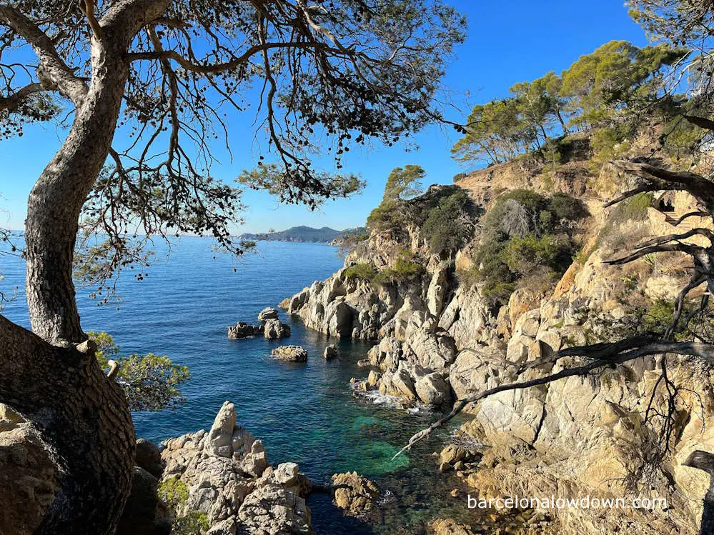
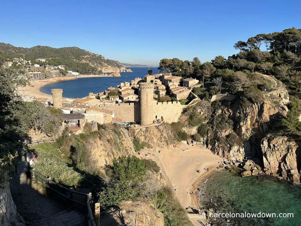
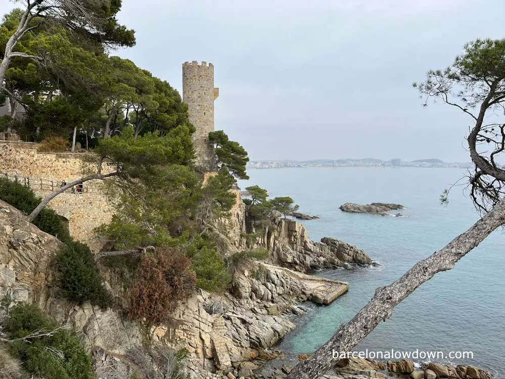
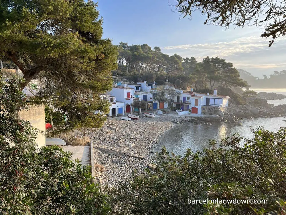
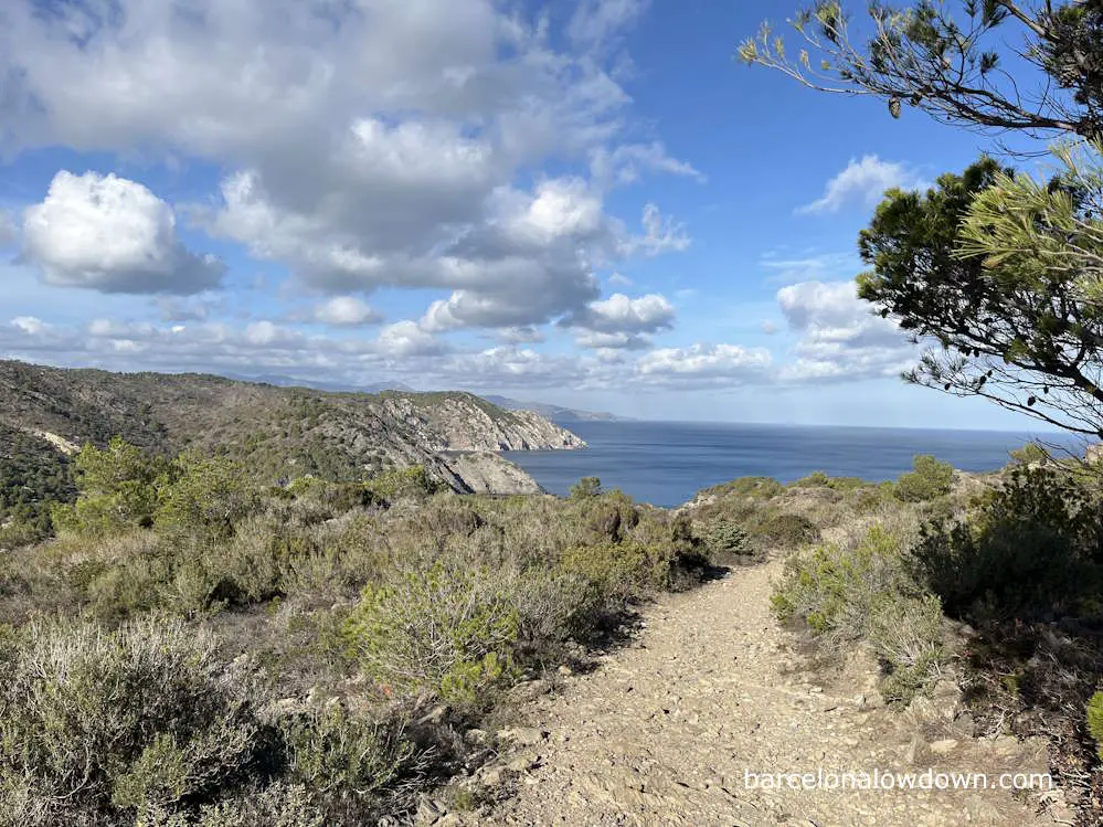
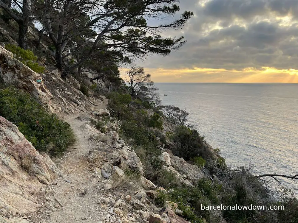
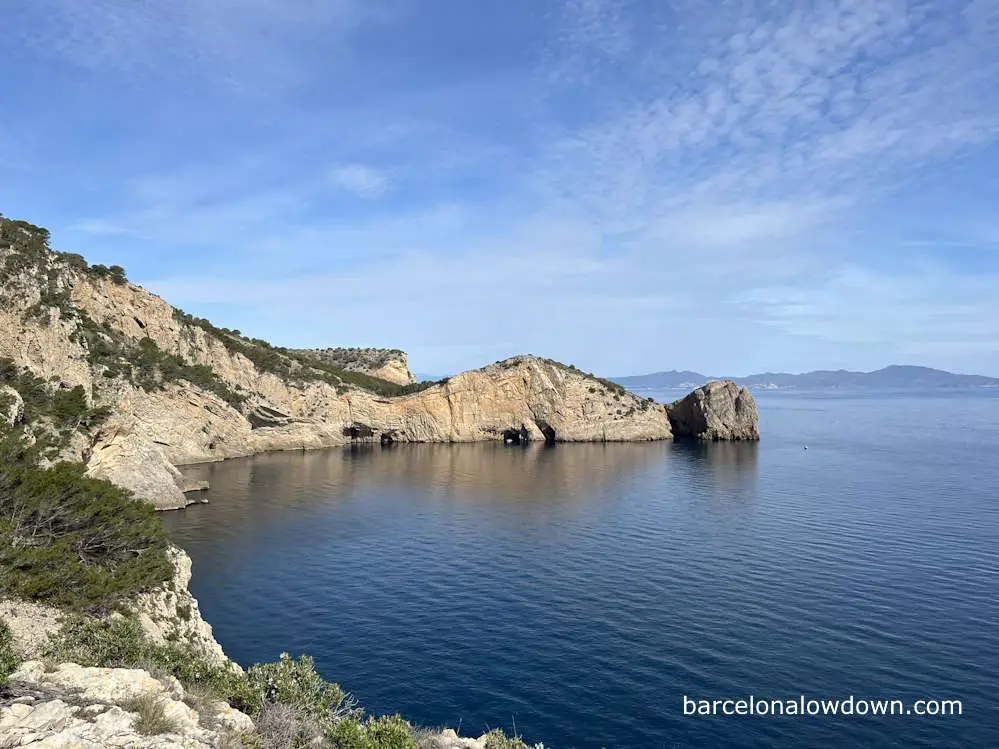
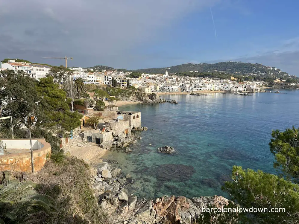
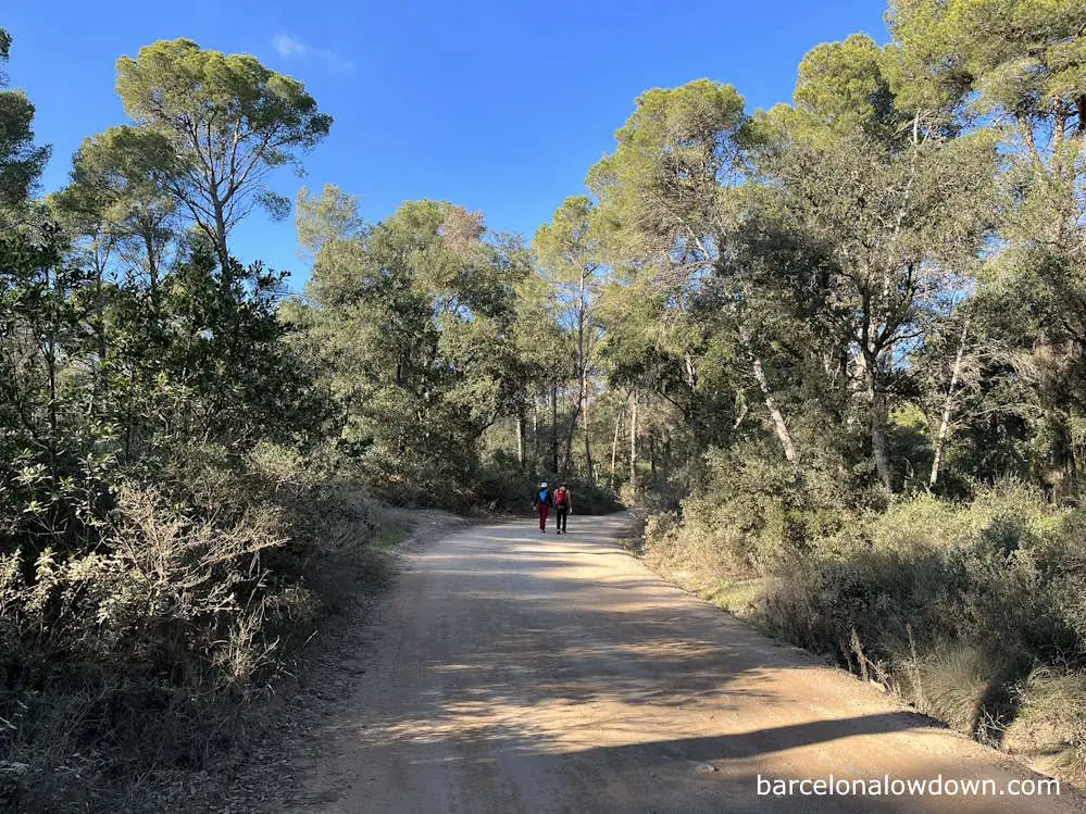
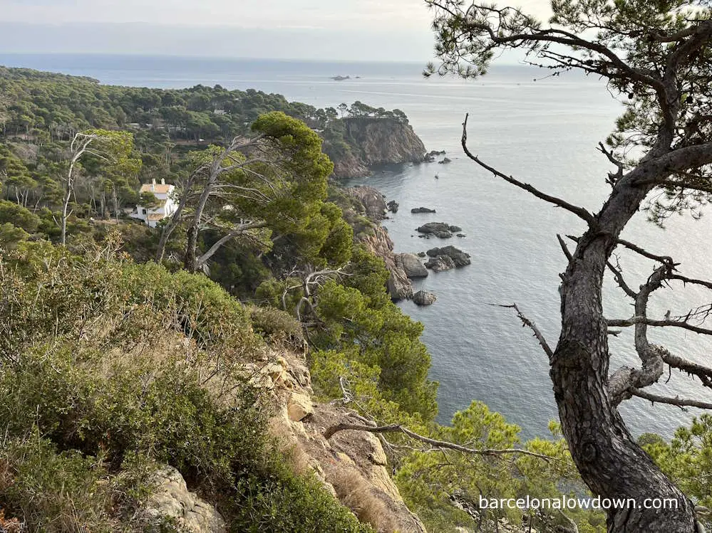
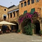
The Costa Brava Coastal Path is an easy and picturesque hike. The route takes you to small fishing villages, pristine beaches, medieval castles and numerous rocky coves, many of which are only accessible on foot or by boat.
During much of the hike, you’re walking alongside cliffs shaded by pine forests, offering stunning views of the turquoise waters of the Mediterranean below.
Most of the larger Costa Brava resorts are located in the southern section of the route, from Blanes to L’Estartit. However, this doesn’t detract from the area’s natural beauty. Indeed, many of the route’s most scenic sections are on this part.
From L’Estartit to Roses, the terrain is mostly flat, and you hike along endless sandy beaches and through a wetland nature reserve, which is used by migratory birds.
Heading north from the town of Roses, you come to Cap de Creus National Park, which is a rocky headland, the easternmost point on the Iberian peninsula. Strong winds frequently blow in this area, and the landscape is more barren and rugged.
Finally, the last stretch of the Costa Brava Coastal Path from El Port de la Selva to Llançà is once again flat before the final hilly section from Llançà to Portbou, via the Coll del Frare.
Along the way, you hike on a wide variety of terrains, including gravel footpaths, rocky tracks, unsurfaced forest roads and sandy beaches. There are also a few tarmac sections, mostly in seaside resorts where the route is usually along the town’s promenade or boardwalk.
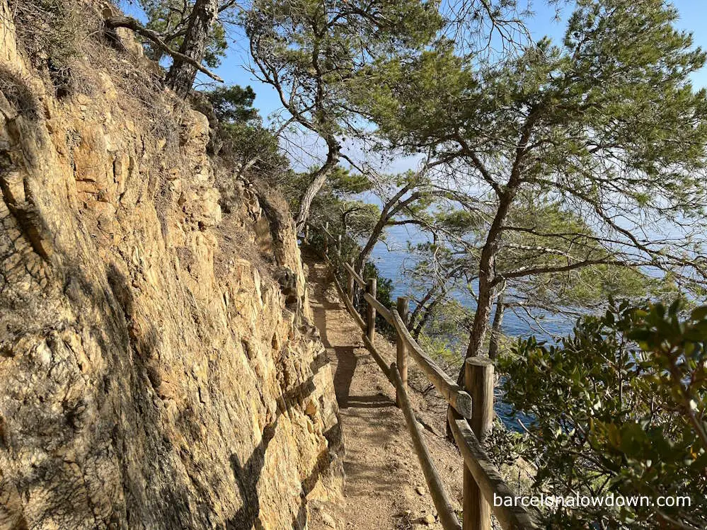
The trail is clearly marked and isn’t technically difficult. On the sections of the path that run alongside the cliffs, there are normally handrails and steps wherever needed. This is especially true in the southern section, which is the most frequently visited part of the trail.
If this is your first multi-day hike, then the distance will be the main challenge. Most people complete the trail in ten stages, an average of twenty-three kilometres per day. The longest day is more than thirty kilometres, which is quite long despite being mostly flat.
I think allowing at least twelve days is a good idea if you have time. This allows you to have a couple of rest days and take a break from hiking. It’s well worth spending a couple of nights in Cadaques and Tossa de Mar. The Monastery of Sant Pere de Rodes, near El Port de la Selva, is also worth visiting if you have time.
Guidebooks and planning
The only English language guidebook which covers the entire Costa Brava Coastal Path is Camins de Ronda, the Costa Brava Way by Sergi Lara and Jordi Puig. Now in its tenth edition, it’s an excellent guidebook which includes maps and detailed text descriptions of the routes, as well as photos and information about the towns and villages along the way.
After a short introduction, the book is broken down into chapters dedicated to each of the stages, plus some alternative routes and a couple of extra stages in France.
What I like about this book is that it is equally suitable for people who only want to walk individual sections as it is for people who will be walking the full 230 km. It’s also small enough to fit comfortably into your backpack.
Accommodation along the Costa Brava Coastal Path
The Costa Brava is one of the most popular areas of Spain amongst European holidaymakers, and there are plenty of hotels to suit all budgets. Having said that, outside the main holiday season, which runs from April through to October, many of the larger hotels are closed, so, no matter what time of year you plan to visit, it’s best to book in advance.
I recommend using Booking.com for hotel reservations because many of the hotels listed offer free cancellation, allowing you to book early and then cancel or modify your booking if your plans change.
When hiking, I look for budget hotels in good locations. I figure that since I’ll only be staying for one night, there’s no need to pay for extra amenities, which I’m not going to use. The table below lists the hotels I stayed in when hiking the Costa Brava Coastal Path.
| Town | Hotel |
| Tossa de Mar | Hostal Codolar |
| Sant Feliu de Guíxols | Hostal Zurich |
| Palamós | Hotel Marina |
| Begur | Hotel Rosa |
| L’Estartit | Malva Hostel |
| L’Escala | Pensio Torrent |
| Roses | Hotel Vela |
| Cadaqués | Hostal El Ranxo |
| El Port de la Selva | Hotel Agora |
If you are looking for maximum flexibility and don’t mind carrying some extra weight in the form of a tent and camping equipment, then there are plenty of campsites along the route. Generally speaking, they are large campsites that mostly cater for families with RVs, caravans or larger tents. Most sites include a supermarket, restaurant, swimming pool and even entertainment for the kids.
During the peak holiday season, from mid-June to the end of August, many of the campsites will be fully booked, so it’s best to phone in advance. Most campsites on the Costa Brava close for winter at the end of October and then re-open again at Easter.
Food and drink
Catalonia is famous for good food, and you will find plenty of dining options for all budgets.
The Costa Brava is especially famous for seafood, but vegetarians and even vegans will always be able to find something to eat, although the latter may find that the choice is rather limited. This is especially true in the winter when many restaurants that cater to tourists close or only open on weekends.
The Spanish generally eat late, and lunch is normally served from 13:00 to 16:00 and the evening meal from 20:00 to 22:00, although there will usually be places geared towards tourists that are open outside these time slots.
Bars (basically small informal restaurants) and bakeries will generally serve French bread sandwiches and pastries from about 7:00 until they close at about 23:00, although they may refuse to serve sandwiches at lunchtime.
All of the towns, plus most of the villages along the way, have supermarkets, bakeries and convenience stores where you can stock up as needed, so there’s generally no need to carry more than water and a few snacks.
As mentioned earlier, most of the campsites on the Costa Brava are large and will have a small supermarket onsite, although it will generally be cheaper if you shop in the towns.
Finding your way
You don’t need to worry about getting lost as the entire route is on marked footpaths.
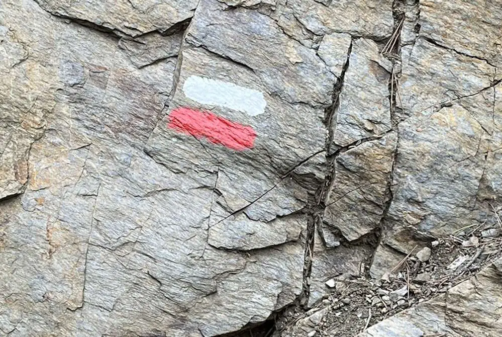
Sometimes, there will be signposts with the names of towns and villages and estimated walking times. Other times, there will be marks painted on trees and rocks indicating the way. Often, there are signs indicating Camins de Ronda or Travessera del Mediterrani.
As I’ve already mentioned, the Costa Brava Coastal Path combines the old Camins de Ronda paths with sections of the GR 92 long-distance footpath and other marked trails.
The GR 92 is marked with white and red parallel lines, as shown in the photo below. When you come to an intersection, the right way will be marked with two parallel lines, and the wrong way will be marked with a cross. Other paths, such as the PR-C 101, are marked in a similar way but with yellow and white marks.
To make things even easier, I’ve created a series of Wikiloc trails covering the entire route (see table below for links).
Once you’ve installed the Wikiloc app, I recommend upgrading to a premium account, which costs about €10 per year and allows you to download trails and maps offline. This saves on data use and allows the app to function correctly in areas with no network coverage.
If you’re visiting from outside the EU, I recommend you purchase a pre-paid SIM card or eSIM.
The table below has links to ten Wikiloc trails, which I recorded when I walked the Costa Brava Coastal Path from Blanes to Portbou during the winter of 2023/24.
Disclaimer: The trails linked below are a record of the route that I walked and are for information only. If you decide to use them, you do so at your own risk. Please read my full disclaimer here.
You’ll also find that there are plenty of Wikiloc trails by other authors that cover the route. I recommend checking several of them out, comparing them with the maps in the guidebook and deciding which you prefer.
It’s best to choose trails which have been uploaded recently since sections of the trail may have been closed for maintenance or due to erosion. Talking of closures, even if you will be using GPS tracks, it’s still a good idea to carry the guidebook or a map with you in case you have to modify your route along the way.
Getting to the Costa Brava Coastal Path from Barcelona
The stages’ start and end points can be reached by public transport from Barcelona in between two hours and three and a half hours. In some cases, especially when travelling outside the main holiday season, it will be faster to go via Figueres or Blanes and in some cases, this may be the only option.
If you will be travelling directly from Barcelona airport to the Costa Brava, there may be a direct bus available, or you may have to go via Barcelona. I’ve covered this in detail in this post.
Generally speaking, buses from Barcelona to the Costa Brava are more frequent during the main holiday season, from June to September, and less frequent in winter.
It’s difficult to give an exact recommendation, but generally speaking, my preferred modes of transport will be as shown in the table below. However, this is only a general guide, and I recommend that you spend a few minutes checking timetables on the websites listed in the resources section of this post.
| Destination | Mode of Transport |
| Blanes | Regional train from Barcelona Sants (R1) |
| Tossa de Mar | Regional train to Blanes followed by a bus to Tossa de Mar. |
| Sant Feliu de Guíxols | Take a train to Girona, followed by a bus to Sant Feliu de Guixols or a direct bus from Barcelona. |
| Palamós | Take a train to Girona or Caldes de Malavella, followed by a bus to Palamós or a direct bus from Barcelona. |
| Begur | Take a train to Girona, followed by a bus to Begur or a direct bus from Barcelona. |
| L’Estartit | Train to Figueres or Llança, followed by a bus to L’Estartit |
| L’Escala | Take a train to Figueres, followed by a bus to L’Escala or a direct bus from Barcelona. |
| Roses | Take a train to Figueres followed by a bus to Roses or a direct bus from Barcelona. |
| Cadaqués | Take a train to Figueres followed by a bus to Cadaqués or a direct bus from Barcelona. |
| El Port de la Selva | Train to Figueres or Llança followed by a bus to El Port de la Selva |
| Portbou | Regional (R11) or MiddleDistance trains |
Transferring between towns on the Costa Brava
Bus services between the towns on the Costa Brava are, broadly speaking, organised into three sections: Costa Brava North, from L’Escala to Portbou; Costa Brava Middle, from Sant Feliu de Guíxols to L’Escala and Costa Brava South, from Blanes to Tossa de Mar.
There are direct bus services between the towns within the Costa Brava South and Costa Brava Middle sections. When travelling between sections and within the Costa Brava North section, you will generally have to go via either Girona or Figueres.
Best footwear for hiking the Costa Brava Coastal Path
If you only plan to walk a section of the Camins de Ronda, then there’s no need to purchase special footwear. Trainers or comfortable shoes are perfectly adequate as long as they have a grippy tread and fit well.
If you will be walking the entire coastal path or several stages of it, I recommend purchasing lightweight walking shoes or trail runners. You don’t need heavy-duty boots because the terrain isn’t bad, and if you follow my packing advice below, you won’t be carrying too much weight.
I wore my tried-and-tested Merrell MOAB hiking shoes, which were ideal because they are lightweight and have quality Vibram soles, which provide more than enough protection and support for carrying a backpack for long distances across varied surfaces.
Whatever shoes you choose, to avoid blisters, be sure to wear them for a few practice hikes beforehand and combine them with good-quality hiking socks.
Camins de Ronda packing list
The golden rule for long-distance hiking is to carry as little as possible. This is especially true for hikes like the Camins de Ronda or the Camino de Santiago, where you are hiking between towns and villages and can easily purchase things along the way when needed.
If you stick to the list below, you should end up with a pack weight of around 5kg. Add to that 1.5 litres of water and a few snacks, and it should still weigh less than eight kilos.
You’ll notice that I only recommend carrying three sets of underwear and two T-shirts. The idea is that you wash your underwear and T-shirt at the end of each day’s hike and hang them out to dry overnight. If they don’t fully dry, you hang them from your pack to dry during the next day’s hike.
If hiking during the winter, or when bad weather is forecast, you may want to carry four sets and visit a self-service laundry when needed.
- Twenty-five to thirty-litre rucksack. Make sure that it’s the right size for you and has a padded waist belt and a rain cover.
- Two short-sleeved T-shirts
- One long-sleeved T-shirt
- Convertible hiking pants
- Second pair of long trousers (shorts in summer).
- Swimming costume (not needed in the winter)
- Mid-weight fleece jacket (not needed if hiking in the summer)
- Waterproof jacket (used for wind protection at any time of year)
- Waterproof trousers (not needed in the summer)
- Underwear (three sets)
- Socks (three sets)
- Minimalist wash kit (comb, toothbrush, toothpaste and bar unscented soap so you can use it to wash your clothes).
- Minimalist first aid kit (A few sticking plasters, Compeed, tape and antiseptic cream)
- Cap (woolly hat and gloves if walking in winter)
- Sunscreen (SPF 50 in summer and 15 in winter, just in case)
- Flip flops (or sandals or crocs for when not hiking)
- Washing line
- Smartphone and charger
- Sunglasses
- Small mesh bag for hanging damp underwear from your pack while it drys (see above)
- Two 0.8L water bottles
Health centres, pharmacies and the emergency services
As I’ve already mentioned, the Costa Brava Coastal Path is an easy and very safe trek that is suitable for novice backpackers. The chances of injuring yourself on the hike are minimal, and you are unlikely to suffer anything more serious than sunburn or blisters due to badly fitting shoes.
Even so, I recommend that you take out travel insurance and ensure it covers you for hiking.
If you get sick or run out of medication, I recommend you follow my advice in this post. For colds and minor illnesses, it’s best to visit a pharmacy or health centre (called CAP in Spanish and Catalan).
To find the nearest health centre, I recommend you use the search functionality on this page, which is the official website of the Generalitat de Catalunya (the local government).
For more serious cases, the telephone number for the emergency services is 112.
I’ve compiled a list of pharmacies at the end points of each stage. Most towns will have several pharmacies. I’ve only listed one per town, generally, the one which is nearest to the seafront or most central. If a pharmacy is closed, there will be a notice near the door with the opening times and a list of other local pharmacies which are on call.
| Town | Pharmacy | Address |
| Blanes | Farmàcia Sureda Casamor | Passeig de Dintre, 3 |
| Tossa de Mar | Farmàcia Arbussé | Carrer la Guàrdia, 19 |
| Sant Feliu de Guíxols | Farmàcia Francesc de la Peña Vilà | Anselm Clavé, 8 |
| Palamós | Victòria Clarés Vigo | Carrer President Macià, 62 |
| Begur | Farmàcia Es Mirador | Plaça Forgas, 11 |
| L’Estartit | Farmàcia Nuria S Ballester | Carrer d’Eivissa, 10 |
| L’Escala | Farmàcia L’Escala – Lluís Cendra | Carrer de l’Ave Maria, 3 |
| Roses | Farmàcia del Carrer Major | Carrer Dr. Pi i Sunyer, 5 |
| Cadaques | Farmàcia Eva Moradell Llobet | Plaça Frederic Rahola, 9 |
| El Port de la Selva | Farmàcia Sala | Carrer del Mar, 8 |
Self-service laundries on the Costa Brava Coastal Path
As mentioned above, I recommend travelling light and hand washing a few items daily. If the weather’s bad, you may need to use a laundry. The following table is a list of self-service laundries at the end points of each stage (one per town where available).
| Town | Laundry | Address | Open |
| Blanes | La Bugaderia de Blanes | Carrer Josep Tarradellas, 5 | 8 am to 10 pm |
| Tossa de Mar | Open Wash Lavanderia | Carrer Nou, 43 | 8 am to 11 pm |
| Sant Feliu de Guíxols | Lavandería Autoservicio LavaXpres | Ctra. de Girona, 9 | 8 am to 10 pm |
| Palamós | Speed Queen | Carrer del Carmel, 54 | 8 am to 10 pm |
| L’Estartit | Blaumar Bugaderia | Carrer Freu, 25 | 8:30 am 8 pm |
| L’Escala | Lavanderia autoservicio Safareig | Avinguda de Montgó, 2 | 8 am to 10 pm |
| Roses | LavaXpres | Carrer del Cap Norfeu, 3 | 8 am to 10 pm |
Tips & FAQs
Below are some useful tips and frequently asked questions about the Camins de Ronda and Costa Brava Coastal Path. If you have any further questions, feel free to leave them in the comments section, and I’ll get back to you as soon as possible.
What is the best time of year to hike the Costa Brava Coastal Path?
The Costa Brava Coastal Path can be hiked at any time of year. However, the ideal time for hiking is during the spring or autumn seasons, as they fall outside the main holiday season. If you choose to walk during the summer, you must book your accommodation well in advance.
Can you hike just part of the Costa Brava Coastal Path
Yes, the path runs through most of the towns and resorts on the Costa Brava, and many of the best sections are close to towns. A popular option is to hike for a few kilometres to the next town and village and then take a taxi or bus back to where you started.
How long is the Costa Brava Coastal Path?
The Costa Brava Coastal Path is approximately 225 kilometres long and runs from Blanes, in the south, to Portbou near the French border.
How many days does it take to walk the Costa Brava Coastal Path?
The route is typically divided into ten stages and can be hiked in ten days. If you have more time, it’s a good idea to allow yourself two full weeks so that you can spend more time exploring towns such as Tossa de Mar and Cadaques.
Which is the most beautiful section of the Costa Brava Coastal Path?
I enjoyed the entire path, and there are many beautiful places all along the way. If I had to choose one part, it would be the section between Palamós and Calella de Palafrugell.
Is the Costa Brava Coastal Path suitable for novice hikers?
Yes, the Costa Brava Coastal Path is an easy hike that is ideal for novice hikers since the paths are well-maintained and well-marked, and you are never far from the next town or village. The route is beautiful and takes you to a diverse mixture of scenery, so more experienced hikers will also find it enjoyable.
Is guided hiking available on the Costa Brava Coastal Path?
If you prefer to be accompanied by a guide, local company Cami de Ronda offers hiking holidays on the Costa Brava Coastal Path, bag transport, and GPS hire, although I’ve no personal experience or connection with them.
If you are interested in a shorter hike, Get Your Guide offers several tours, which include hiking a section of the Camins de Ronda with a licensed guide and coach transport from Barcelona.
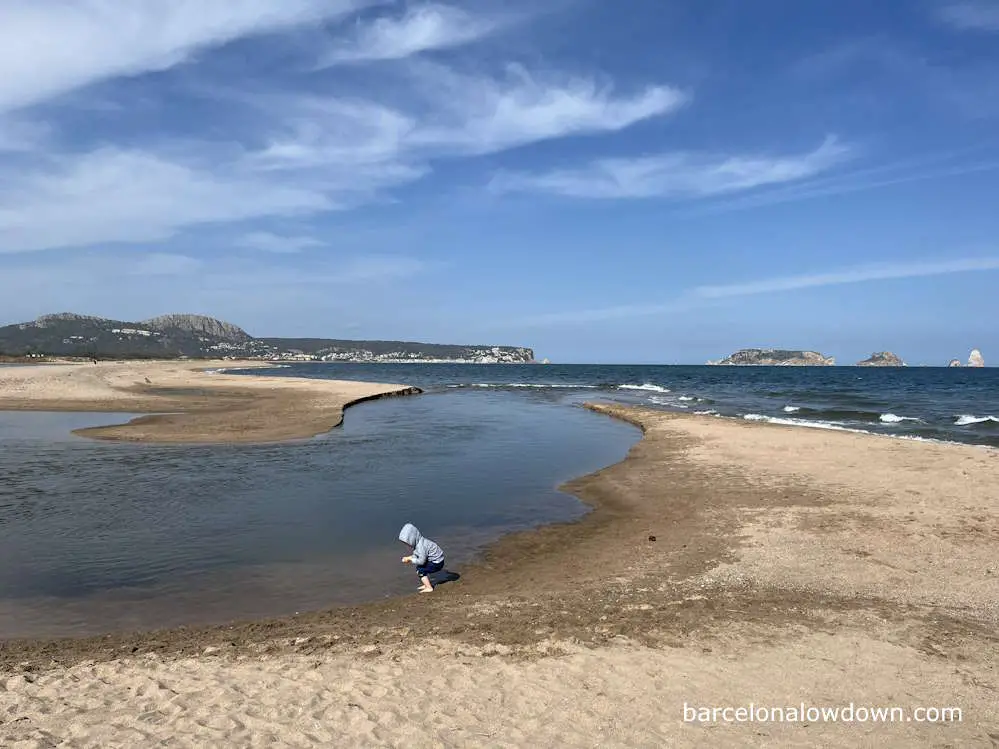
How deep is the river you cross on day five?
Day five of the Costa Brava Coastal Path takes you from Begur to L’Estartit. The guidebook describes two possible routes. The first follows the coast and is approximately 18km in length. The second takes you inland via Pals, a distance of 32km.
I decided to take the coastal option because it seemed more straightforward, and I fancied the idea of walking along the beach. The guidebook mentions that shortly before arriving at l’Esatrtit, you have to ford the River Ter, which is described as being about knee deep.
In reality, the depth of the river seems to vary depending on how much it has rained. When I walked the route, it had rained fairly heavily a week before I was there, and I was surprised to find the water was chest-deep. I’m 180 cm tall, which is about 5ft 11.
When I was in L’Estartit, I got chatting with a local who told me that, after periods of heavy rain, it’s not uncommon for the river to be impassable. My advice is to play it by ear, start early in the day, and if you find the river is too deep or fast-flowing, you can follow this route, which takes you inland to a bridge.
This was an incredibly helpful page. Thank you so much!
Hi Michele,
Thanks for your comment. If you’ve any questions about the Camins de Ronda which aren’t covered in the article feel free to ask.