The PR-C 171 trail is an easy twenty-kilometre hike through the Collserola mountain range, which visits the peaks of Sant Pere Màrtir, Tibidabo and El Turó de Santa Maria and offers breathtaking panoramic views of Barcelona, along the coast, and inland towards Montserrat and nearby cities like Sant Cugat del Vallès.
The trail takes between four and a half and five hours to complete and is suitable for walkers of all abilities and ages. Most of the route is signposted and follows footpaths and forest tracks, although there are a couple of short sections of tarmac. I’ve created a Wikiloc trail, which you can download here.
The other big advantage of the PR-C 171, apart from the views, is accessibility because the walk starts and finishes within Barcelona and can be easily and quickly reached by metro. In fact, if you get up early, you can complete the walk and be back in the city centre by lunchtime.
Along the way, there are several small bars and restaurants where you can stop for a coffee or a meal. If you’re travelling with children, or if twenty kilometres sounds too much, you can break the journey by taking either the funicular from Vallvidrera or the bus from Tibidabo.
PR-C 171 from Zona Universitaria to Trinitat Nova
The hike starts at the Zona Universitaria metro station, which is on the L3 and L9 lines. From here, we take the Parc de Cervantes exit and walk a few metres along Av. Diagonal before skirting around the park towards the Ronda de Dalt ring road.
After crossing the bridge over the ring road, we follow Pg. de Sant Joan de Deu uphill past the Sant Joan de Deu Children’s Hospital. Immediately after the hospital, we turn right along Carrer de Finestrelles, then take the second left, amongst the houses, along Carrer de Joan Miró.
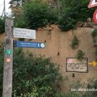
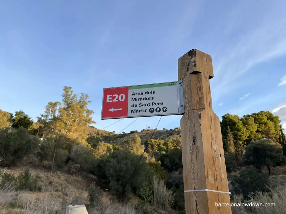
After two blocks, we turn right and walk another two blocks along Av. de Jacint Esteva Fontanet, which takes us to the edge of Collserola Park. Ten minutes after exiting the metro station, we pick up the E20 footpath and follow the signs towards Àrea dels Miradors de Sant Pere Màrtir.
At first, the path is paved, but after about a hundred metres, we turn right after the electricity pylon and follow the dirt track uphill towards Sant Pere Màrtir.
A few minutes later, we come to a road leading to a car park near the start of the Carretera de les Aigües. There’s a small open-air restaurant here called Espai Mireia, which caters to walkers and cyclists and opens at nine a.m. I’ve not stopped here, but it gets good reviews on Google.
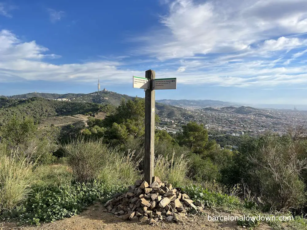
From here, we pick up the Passeig de les Aïgues and follow the signs towards Ruïnes de Sant Pere Martir. At this point, there are views across the southern part of Barcelona, L’Hospitalet and Barcelona Airport.
Turning left, we follow a path to the Deposit de Sant Pere Martir, which is an old water pumping station. Here, the path crosses a long wooden bridge that leads us to the Mirador del Xipres, a panoramic viewpoint that marks the start of the Carretera de les Aigües.
At this point, we leave the main path and follow a track uphill towards the red and white antenna, which marks the peak of Sant Pere Màrtir.
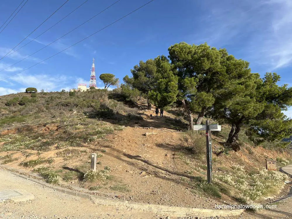
This section is the steepest part of the hike and also the roughest section of the footpath. It’s not too challenging, and I think that most people won’t have any difficulty. As we ascend, we see the first wooden signposts indicating that we are following the PR-C 171.
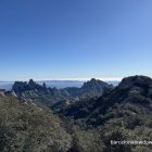
Approximately one hour after leaving the metro station at Zona Universitaria, we arrive at the peak of Sant Pere Màrtir, where we can enjoy a full 360-degree panoramic view of Barcelona and the surrounding area.
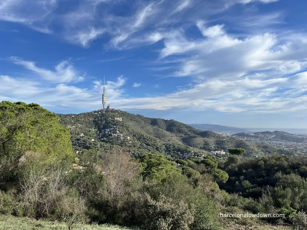
From here, we follow a wide forest track which runs almost almost directly due north. Along the way, there are plenty of wooden route markers, but, at this point, they’re unnecessary because you can clearly see the Torre Collserola and the Basilica of the Sacred Heart up ahead.
After passing the Coll del Portal and the peak of Muntanya Paleda, or Bare Mountain, we come to a small clearing with a bench where you can sit and enjoy the views of Barcelona. Here, we take a narrow path through the trees to the left, which leads to another small clearing with views inland in the opposite direction.
After the clearing, we come to a small car park and a road leading to Vallvidrera and downhill into Barcelona. We follow alongside the road for a few metres until we come to a waste disposal point, where we cross the main road and take a lane, which we then follow into the centre of Vallvidrera, a small town with a few Modernista-style buildings including Vallvidrerea funicular railway station.
As we continue through the town, we quickly arrive at Plaça Vallvidrera. Despite the name, there’s not much of a plaza here, but there is a decent restaurant called Casa Trampa, where you can stop for a coffee or a bite to eat.
From here, we continue on up the steps and then follow the road to the Vallvidrera funicular station. Just past the station, you’ll find a bus stop where there are usually a few people waiting to catch the bus to the Tibidabo Amusement Park and the Church of the Sagrada Cor. There are also a couple of small coffee shops here.
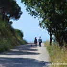
As we leave Vallvidrera town, we continue alongside the road towards Torre Collserola and the Tibidabo Amusement Park. There’s not usually much traffic, and the path is separated from the road by a metal barrier.
To our right are more views of Barcelona and out to sea. At the fork in the road, which leads to the amusement park, we take the road to the right and continue on past the Observatori Fabra towards the Turó de Santa Maria.
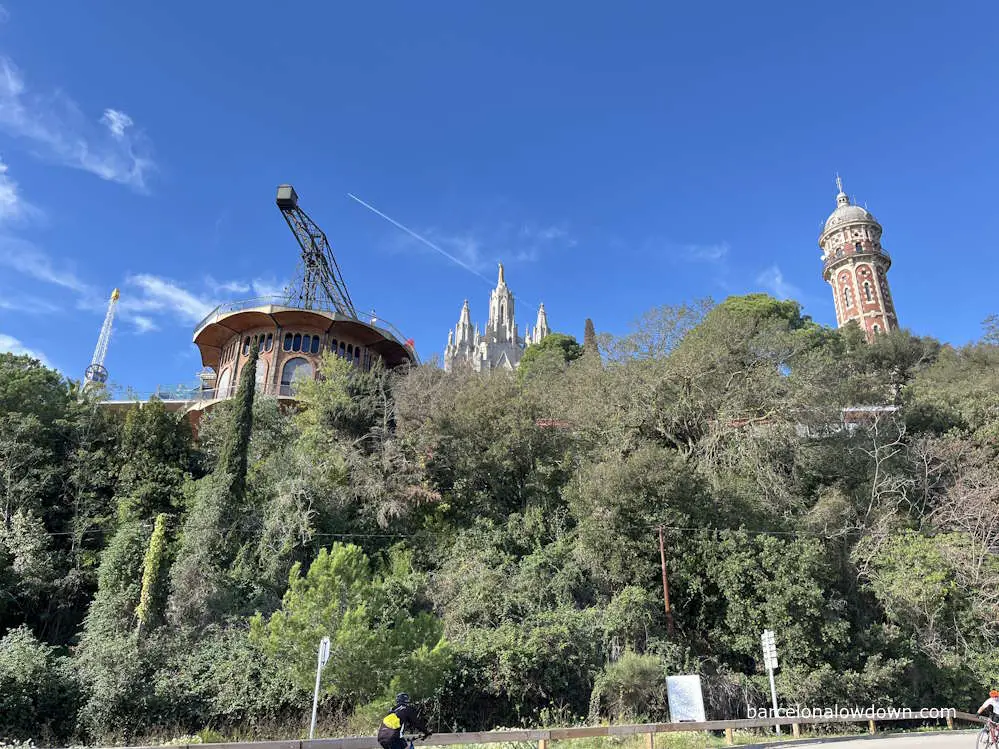
Mount Tibidabo is both the highest point and the halfway mark of the trail. From here onwards, we’ll mostly be walking downhill, although there are a couple of short uphill sections.
As we continue to follow the road past the Tibidabo Amusement Park, we come to a second intersection, where we once again take the road to the right. Shortly afterwards, we pass a quirky house with a glass dome and a helicopter on the roof.
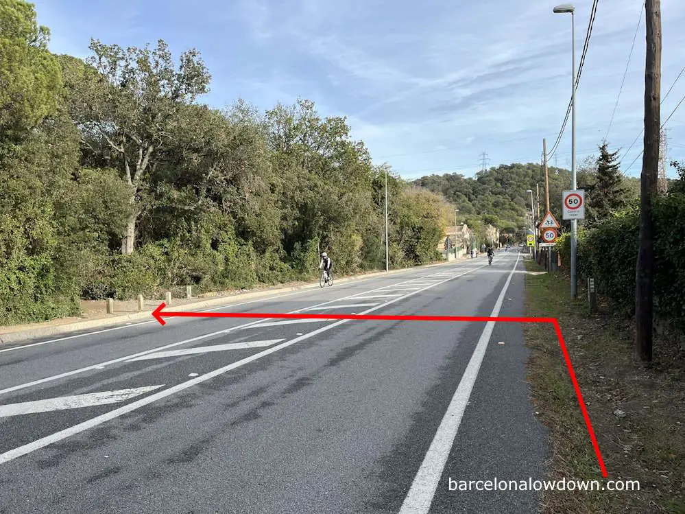
After a couple of hundred metres, we pass a gravel car park with a sign that reads Jardins del viver de Can Borni and, beyond that, the BP-1471 road from Barcelona to Sant Cugat del Vallès. Turning right at the junction, we briefly walk alongside the BP-1471 before crossing the road and heading back into the woods.
After crossing the road, you’ll see a PR-C 171 marker on one of the wooden posts at the start of the footpath. From here onwards, we leave the tarmac behind and are back on a mixture of footpaths and unsurfaced forest roads for the rest of the hike.
Shortly after crossing the road, we pass a colourfully painted workshop where there’s a small car park and a drinking fountain before following the footpath uphill to the peak of the Turó de Santa Maria.
After a brief uphill section through the trees, we rejoin Passeig de les Aigües, which we follow all the way to Torre Baró. There are several lookout points along the way, with views over Barcelona and well as inland towards Sant Cugat and Montserrat.
If you’ve already walked the GR-6 from Barcelona de Sant Cugat, you’ll probably recognise a short section of the trail here. Likewise, veterans of the Camino de Santiago will spot a few familiar yellow arrows along this stretch.
Shortly after crossing the metal bridge at Coll de la Ventosa we come to a small restaurant, set back slightly from the track. If you decide to stop for a coffee here, you need to be aware that they don’t accept credit cards for payments under €5.
From here, the path winds around the hillside towards the Castell de Torre Baró, which was originally designed as a hotel. The project was never completed, and the building is now open to the public and is a popular lookout point.
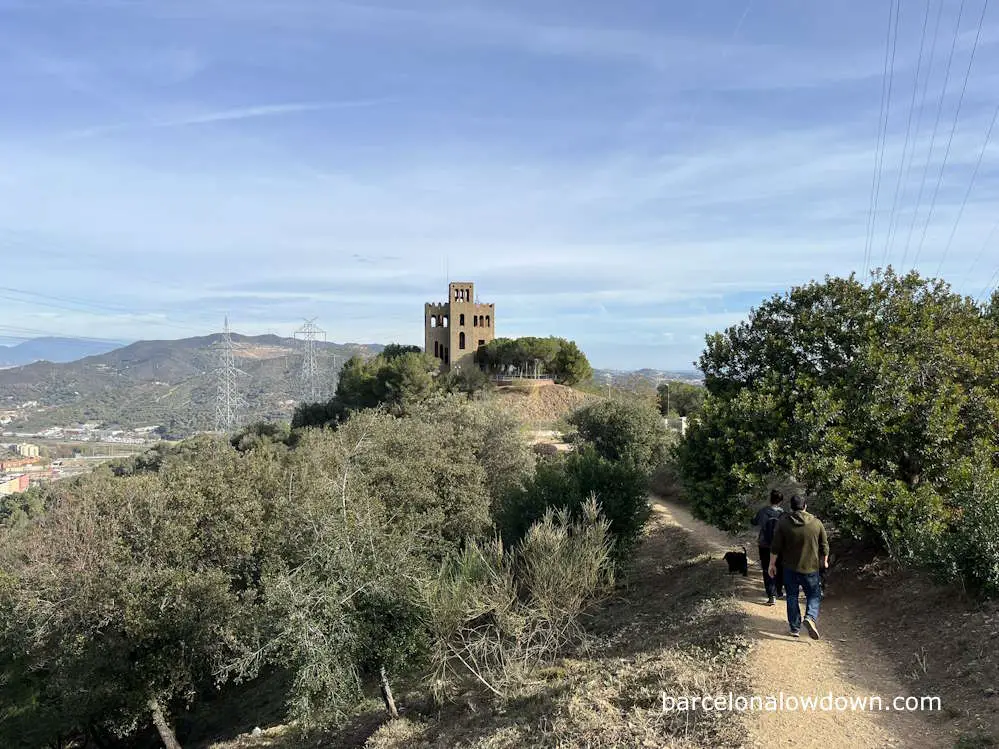
In front of the tower, there’s a small car park from where we follow a footpath downhill towards the Nou Barris neighbourhood. As we pass the electricity pylons and patches of prickly pears, we get views over Badalana, Santa Coloma and the northern districts of Barcelona.
After a short descent, we arrive at a water distribution plant, where we turn left and follow the road for about two hundred metres to the Trinitat Nova metro station, which marks the end of the walk.
From here, we catch the L4 metro back to Barcelona’s city centre. The metro stations at both ends of the hike are within travel zone one.
PR-C 171 Hike in Barcelona:
Starts from: Zona Universitaria metro station (Barcelona)
Ends at: Trinitat Nova metro station (Barcelona)
Wikiloc trail: here
Difficulty: Moderate
Duration: 5 hours
Suitable footwear: Walking shoes/trainers