This post describes the section of the GR 6 long-distance hiking trail from Barcelona to Sant Cugat. The hike is approximately twelve kilometres long and takes about three hours to complete.
The trail starts next to the Parc del Laberint, on the outskirts of Barcelona, and crosses the Collserola Natural Park to the nearby town of Sant Cugat del Vallès.
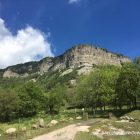
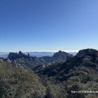
Along the way, you are treated to spectacular views of Barcelona, Mount Tibidabo and Montserrat. If you have time, you could stop off and visit the eleventh-century Romanesque Monastery of Sant Cugat before catching the train back to Barcelona.
Barcelona to Sant Cugat Hike
To get to the start of the trail, catch the L3 metro (green line) to Mundet. If you’re travelling from Plaça de Catalunya, look for signs indicating Trinitat Nova.
Upon arrival at the Mundet metro station, follow the signs indicating Sortida Pg. Vall de Hebron, go up the escalators and through the ticket barriers before turning right following signs to Parc del Laberint d’Horta. Another set of escalators takes you up to street level, from where you can follow this Wikiloc trail to the train station at Sant Cugat.
Upon exiting the metro station, we turn right and briefly follow the slip road, which runs parallel to the main Barcelona ring road, before heading uphill, past a velodrome, towards the Parc del Laberint.
We turn right in front of the steps leading up to the park and follow the perimeter fence uphill. If you need to fill your water bottle, there’s a drinking fountain near the steps leading up to the park.
As we skirt around the edge of the park, we come to a sign indicating that, in addition to the GR-6, we are also following the Camí de Sant Jaume, the Catalan section of the Camino de Santiago. There’s also a hand-painted sign indicating that there’s a little over fifty kilometres, or twelve hours of walking, to go before arriving at Montserrat.
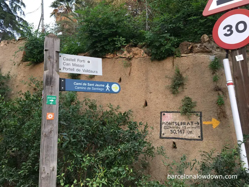
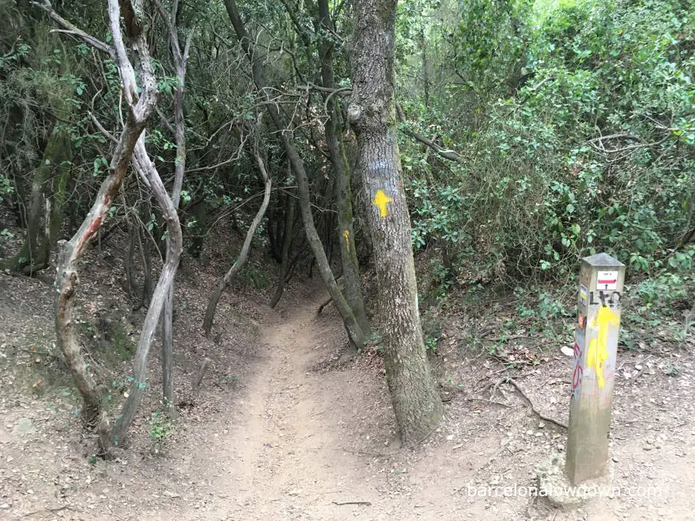
The advantage of following The Camino is that there are frequent, hand-painted arrows, which will lead us all the way to Sant Cugat.
Shortly after passing the painted sign, we leave the paved road and head uphill along a well-worn dirt track. If you look back, you’ll get your first panoramic views of Barcelona.
Following the yellow arrows, we ascend gradually for about a hundred metres before doubling back on ourselves to a cast iron fence. Upon reaching the fence, you’ll see that there is a possible shortcut up a steep and narrow path that, if you’re feeling energetic, you could follow to get here.
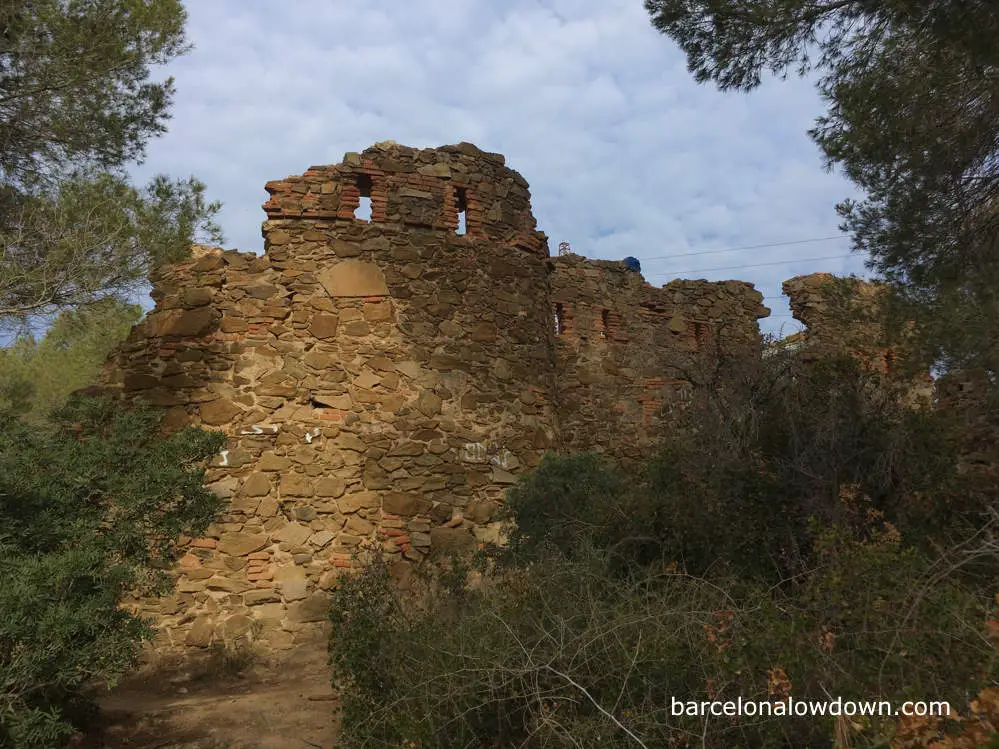
From here, instead of following the yellow arrows, I like to take a slight detour to the Castell del Fortí, which is the ruins of an old military building that dates back to the nineteenth century. After briefly visiting the fort, we rejoin The Camino and continue uphill.
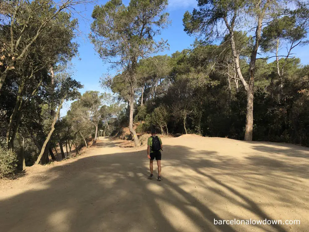
For the next half an hour, we continue upwards through a mixture of olive trees and conifers. This is the most challenging part of the hike, but it’s not difficult, and there are plenty of opportunities to stop and admire the views of Barcelona if you need to catch your breath.
After passing two large electricity pylons, we come to a section of el Camí de les Aigües, where we continue uphill. If you’re walking at the weekend, you should take care of mountain bikers along this section because it’s a very popular route.
About five minutes later, there’s a yellow arrow indicating that we should leave the gravel path and once again head uphill amongst the trees. After a few more metres, we come to the so-called Pas del Rei, where we begin our descent. In case there’s any doubt, about four yellow arrows are painted on the trees here, indicating which way we should go.
The descent initially follows a footpath amongst trees in a shady green tunnel before opening out and briefly joining a greenway or forest road.
We are now on the other side of the Collserola Range and get views of the church on top of Mount Tibidabo. Looking inland and ahead of us, you’ll see the Montserrat mountain range in the distance.
Along this section of the path, it’s not unusual to see wild boar. If you do come across one, you don’t need to be concerned; keep your distance, and they’ll quickly head back into the undergrowth.
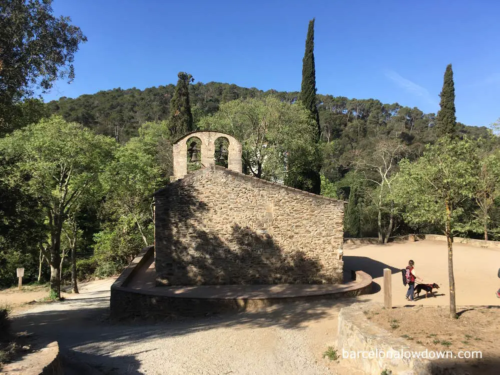
Continuing along the greenway, we pass a few houses before taking a footpath downhill through the trees to the fifteenth-century Hermitage of Sant Medir, where there is a picnic area with tables and water taps where you can refill your water bottle if necessary.
From here on, as we follow the trail to Sant Cugat, you’ll start to encounter more walkers and cyclists. I’ve walked this route several times and am always surprised by how few hikers there are up until this point.
Approximately two kilometres later, we come to Can Borell, a popular restaurant in a traditional Catalan Masía. If you want to have lunch here, it’s probably a good idea to reserve a table in advance.
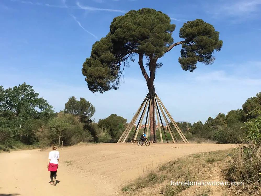
Finally, approaching the outskirts of Sant Cugat, we come to El Pi d’en Xandri, an iconic two-hundred-and-fifty-year-old pine tree. In 1997, the tree was attacked by vandals, who tried to cut it down and set it on fire. Fortunately, the ancient tree survived the attack, although the trunk was severely damaged and needed to be shored up.
Once in the town, we follow the yellow arrows along l’Avinguda de les Corts Catalans, Carrer de Puig i Cadafac and Passeig de Francesc Macià until we come to the Monastery of Sant Cugat, which is a Benedictine Monastery with impressive Romanesque cloisters.
From the Monastery, we follow a pedestrianised street lined with shops to the train station, where we catch the FGC train, lines S1 or S2, back to Plaça de Catalunya. The train journey takes approximately thirty minutes and is covered by one-zone travel passes such as the T-casual and the Hola Barcelona Travel Card.
Barcelona to Sant Cugat hike:
Starts from: Mundet metro station (Barcelona)
Ends at: FGC Sant Cugat train station
Wikiloc trail: here
Difficulty: Moderate
Duration: 3 hours
Suitable footwear: Walking shoes/trainers