This easy, ten-kilometre hike in Montseny Natural Park is best undertaken in spring or early summer when there will be water in the Riera de Martinet. You can also walk it at other times of the year, but the pools and waterfalls near the start of the trail will likely be dry.
The circular route starts and ends on the outskirts of Aiguafreda, a small town in Barcelona province which is easily accessible by car or public transport from Barcelona. The walk, especially the first section along the Riera de Martinet Valley, is a popular excursion for families from Barcelona and other towns nearby.
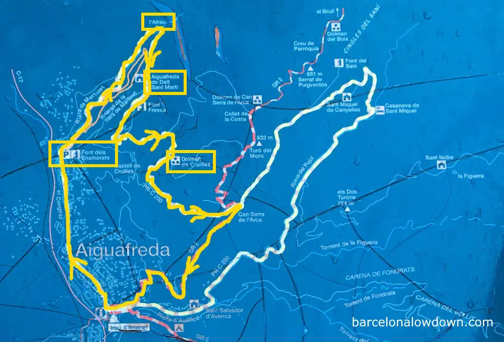
The route follows well-maintained footpaths and forest roads and is clearly marked. From the starting point in Aiguafreda, we follow the yellow and white markers of the PRC–200 until shortly before Can Serra de l’Arce, where we pick up the GR 2, which takes us back into town.
The circuit takes between two and a half and three hours to complete at a leisurely pace. If you have more time, you could follow the entire PRC–200, which is approximately sixteen kilometres long and takes around four and a half hours.
From Aiguafreda to the Gorg de la Sort, La Frau, Aiguafreda de Dalt and the Dolmen de Cruïlles
The walk starts at the Font dels Enamorats drinking fountain, where there is a small car park. Font dels Enamorats means Fountain of Lovers; apparently, water from the fountain has mystical powers.
There’s a stone plaque next to the fountain engraved with a poem by J.Asmarats which reads:
The couple in love,
who like to go to bed,
for them the most precious fountain,
is the Font dels Enamorats.
While you’re here, it’s a good idea to take the opportunity to top up your water bottle because, mystical powers aside, it’s the only source of potable water on the trail. My rule of thumb is to carry 1 litre of water per 10 km per person.
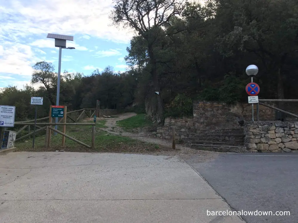
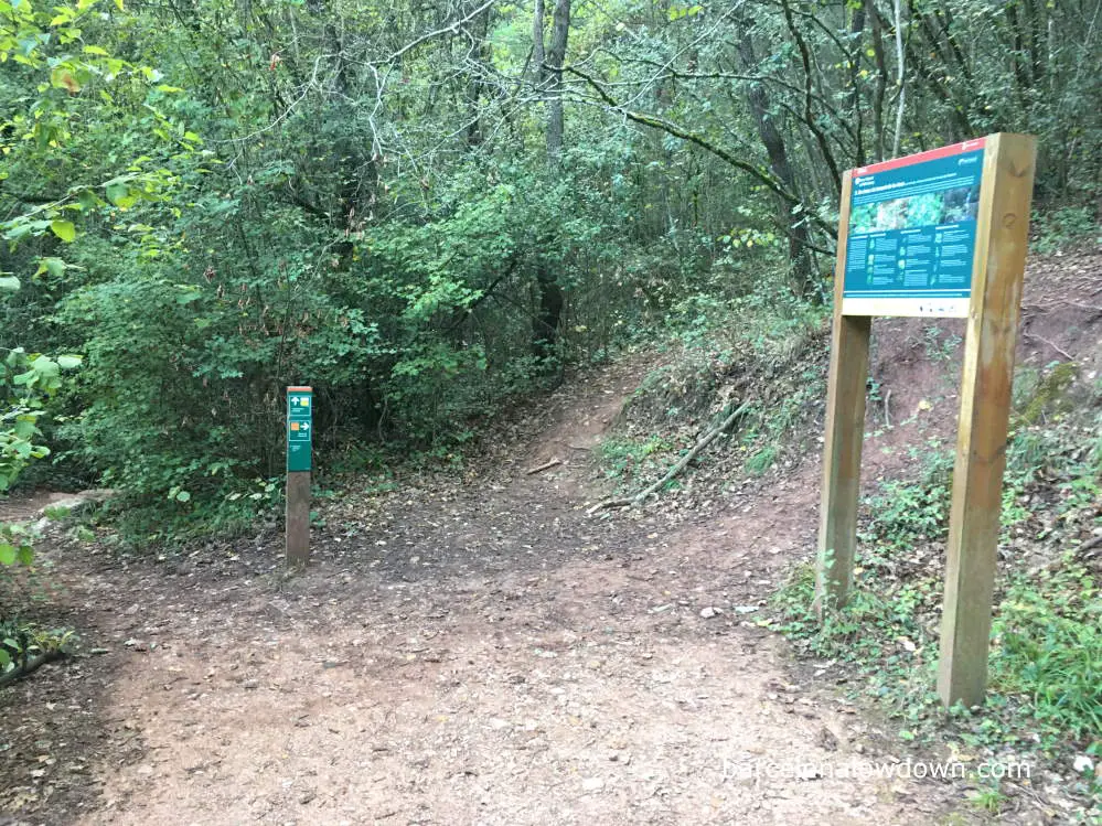
The trail starts right next to the fountain, where there is a wooden marker post with yellow and white stripes indicating the PRC-200, and an orange square indicating a shorter route that remains within the Riera de Martinet valley. Both hikes are shown on the map below.
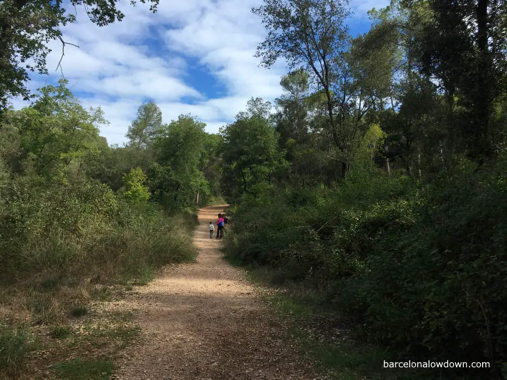
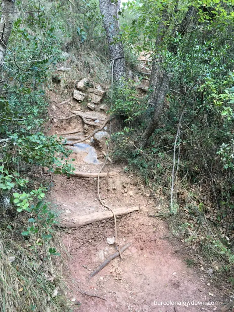
The first stretch of the hike, as far as the Gorg de la Sort, follows along the Riera de Martinet valley. The footpath is wide and easygoing and traverses the right-hand side of the valley above the course of the river, which can be glimpsed through the trees and thick foliage.
Display boards by the side of the path describe species of animals and birds which can be seen in the area. The valley is steep-sided and wooded, and the sun doesn’t start to penetrate the foliage until late morning, and it’s a good idea to bring a light fleece jacket for warmth.
After approximately a kilometre, there is a board explaining the history of the buildings in the Martinet Valley and the origins of a nineteenth-century aqueduct called La Recelosa. A small path beside the sign leads down to the river to the first Gorg (natural pool) on the route. Beside the track is a small brick arch and a channel, all that remains of the aqueduct.
Returning to the main footpath, we continue up the valley until we come to a bifurcation with a small sign indicating that the Gorg de la Sort pool and waterfall are to the left.
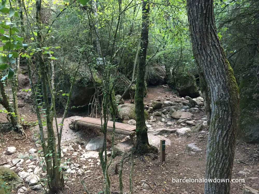
From here, the path leads down some rough stone steps to a small wooden bridge which crosses the river a few metres downstream of the Gorg de la Sort.
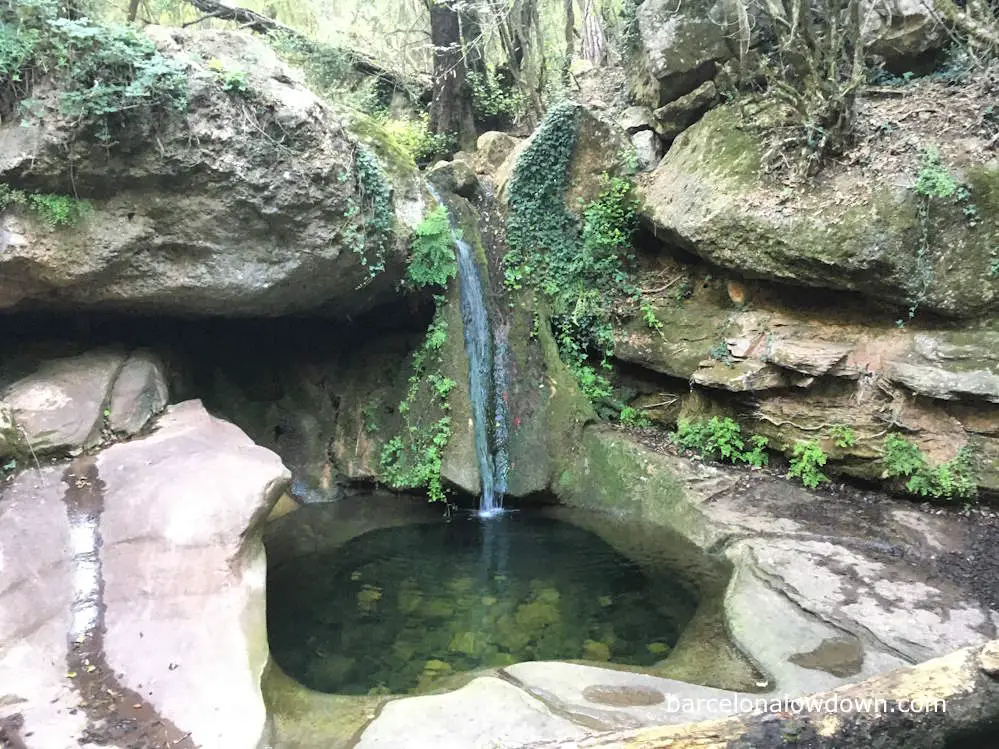
The river dries up during the summer and, if you want to see the waterfalls at their best, you should try to visit in springtime, preferably after heavy rain.
After crossing the bridge, the PRC-200 continues upstream amongst the trees. There is a short scramble up here with a knotted rope to help you, and you should take care if it’s wet.
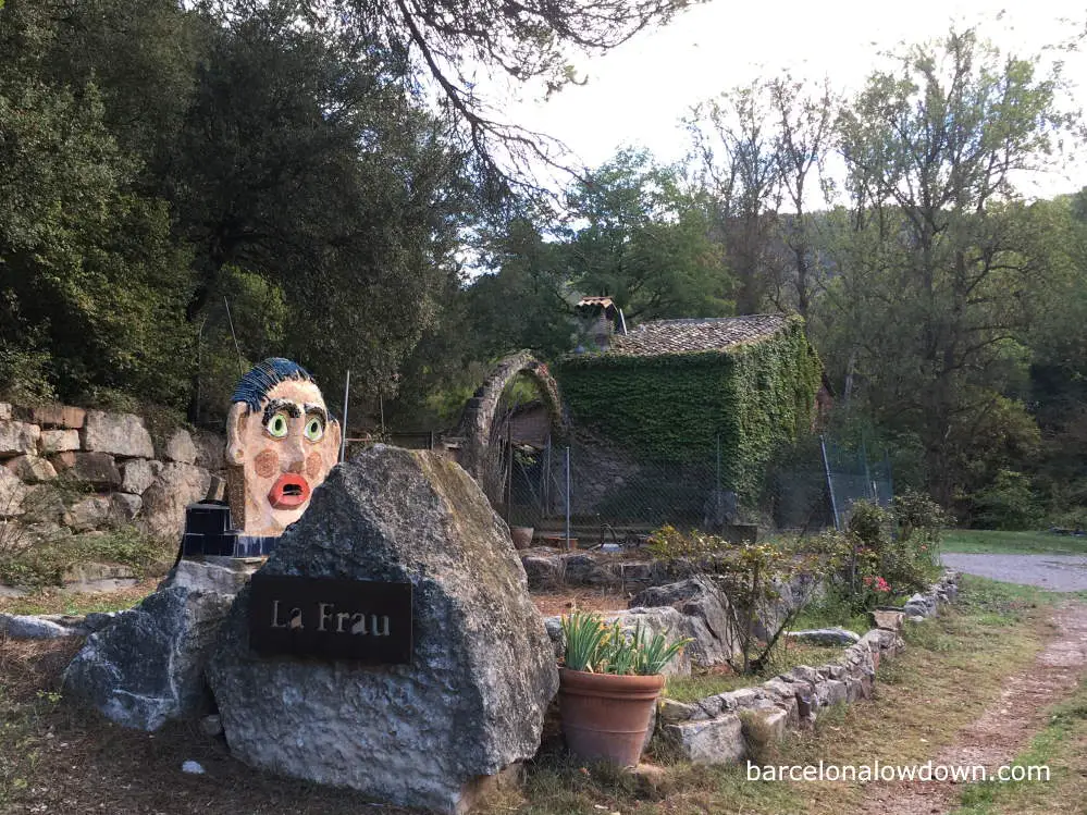
Leaving the waterfall behind us, we continue upwards until the footpath meets a forest road which leads to the Centre d’Art i Natura de la Frau, which used to be a water mill.
From here onwards, the route mostly follows forest roads and is more open and less wooded, often affording panoramic views of the surrounding limestone hills.
Originally a water mill, La Frau is now the home of the artist Paco Ballesteros, who has decorated the grounds with a diverse collection of sculptures that take inspiration from folklore and artists such as Miró and Dalí. The house, which is also Ballesteros’s studio, is open to the public daily from 10:00.
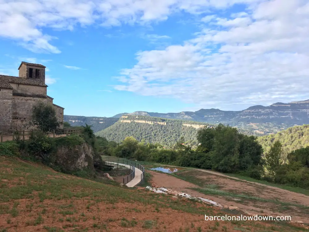
From here, we follow the PR-C200 towards Aiguafreda de Dalt, which was once the main settlement of Aiguafreda. The only buildings that remain are the Church of Sant Martí, the attached rectory and a small walled cemetery.
At Aiguafreda de Dalt, we come to a y-shaped bifurcation, where we follow the yellow and white markers uphill to the left, past some stone picnic tables, towards Can Serra de l’Arce.
The path now heads steadily upwards, and we are afforded views of the surrounding countryside. Along the way, we pass the ruins of Saüce and a small hole in the ground which has been given the rather grand name of La Cueva de l’Infern (The Cave of Hell).
As we continue upwards, the path is intersected three or four times. At each intersection, there is a wooden marker post with yellow and white markings, indicating the PR-C200 and Can Serra de l’Arce.
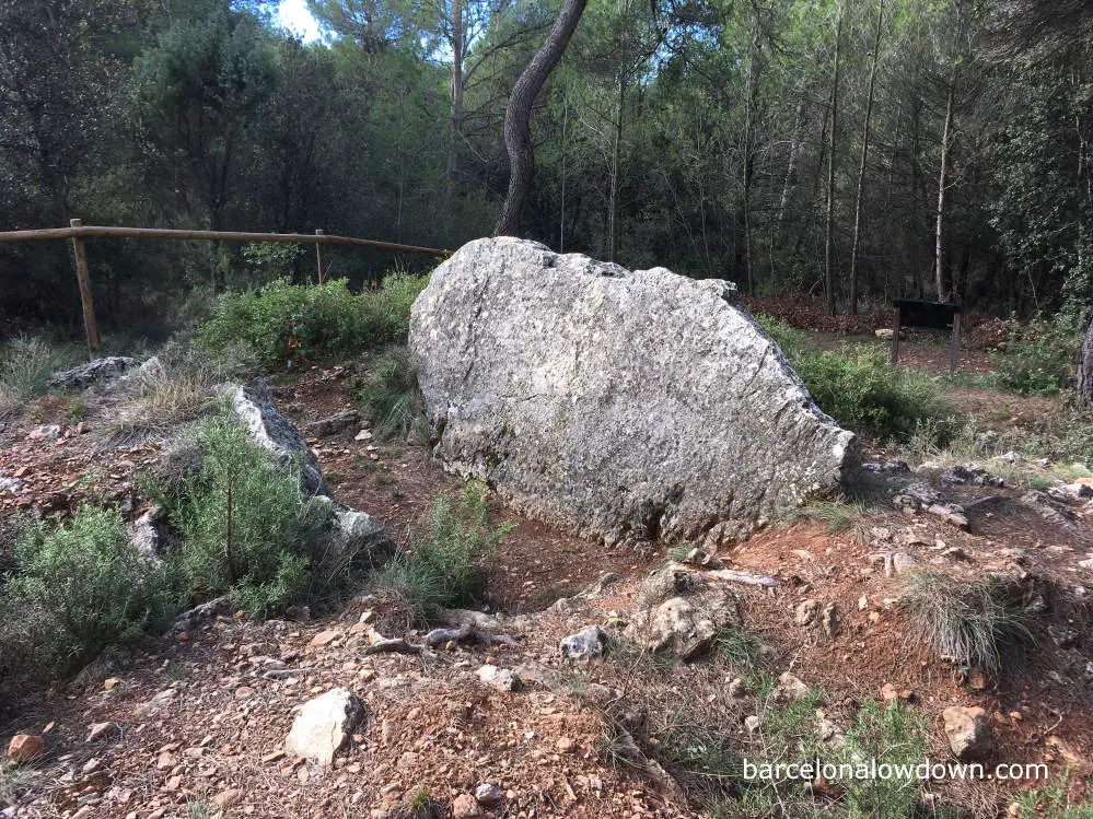
Less than a kilometre after Aiguafreda de Dalt, a small sign indicates where we can take a brief diversion from the trail to visit the prehistoric Dolmen de Cruïlles, which dates back to the Bronze Age.
Unfortunately, the dolmen is no longer standing, and the two large stones which remain lay partially buried. When the dolmen was discovered in 1917, there were three stones, one of which has since disappeared. The site was excavated in 2003 when an assortment of ceramic fragments and the remains of human bones were unearthed.
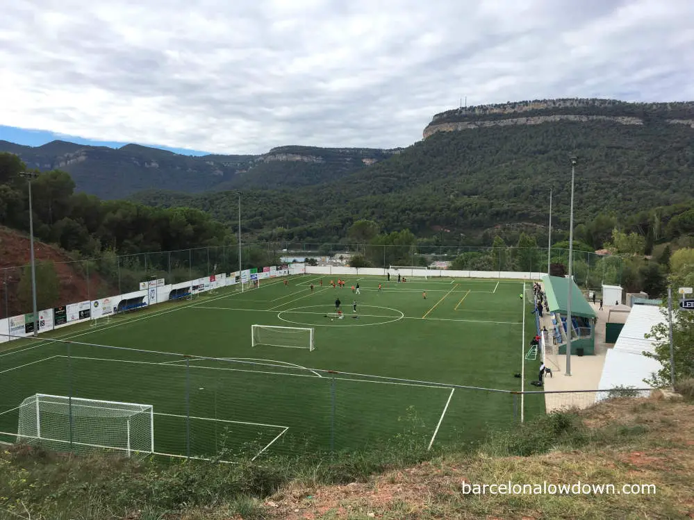
Returning to the path, we continue downhill towards Can Serra de l’Arce. Shortly before arriving at Can Serra, we take the GR 2 downhill to Aiguafreda. Arriving at the town, the GR 2 follows Carrer Cruïlles past the municipal football grounds and some rather alpine-looking chalets.
A few metres later, we come to the main road (N-152a), where we turn right. From here, it’s about a kilometre back to the car park where we started. Alternatively, if you arrived by train from Barcelona, you can turn left and head back to the train station.
If you have time, instead of taking the GR 2 back to Aiguafreda, you could continue along the PR-C 200 to the Hermitage of Sant Miquel de Canyelles and, from there, back to Aiguafreda. This adds approximately six kilometres to the hike and takes an additional hour and a half to complete.
How to get to Aiguafreda from Barcelona
By Car
It takes about an hour to reach Aiguafreda from Barcelona by car. Take the C-17 motorway towards Vic until you see signs to Aiguafreda (exit 39). Follow the N-152a through the town approximately two kilometres until you see a large blue sign indicating AIGUAFREDA DE DALT / PARC NATURAL DEL MONTSENY. The Font dels Enamorats fountain is in the car park beside an old people’s home of the same name.
By Train
It takes approximately an hour to travel from Barcelona to Aiguafreda by train. There isn’t a train station in Aiguafreda, so you should take the R3 line to St. Martí de Centelles. Timetable and stations here.
Aiguafreda and St. Marti de Centelles are adjoining villages built on either side of the Congost River. If you look on Google Maps, you’ll see that they are separated by the C-17 motorway, but the motorway is elevated, and the road which runs under the motorway is apt for pedestrians and cyclists.
It’s approximately a two-kilometre walk from the train station to the Font Dels Enamorats fountain alongside the N-152a. There are several small restaurants on the route where you can stop to eat breakfast or lunch, as well as a Tourist Information kiosk which has maps and information about walks in Montseny Natural Park.
As mentioned in the text above, the last kilometre of the walk follows the N-152a through Aiguafreda back to the Font dels Enamorats car park. When travelling by train, you simply turn left instead of right and walk back to the train station. Wikiloc trail.
There are no ticket barriers at St. Marti de Centelles train station, and it’s important that you remember to validate your ticket at the machine on the platform in front of the ticket office before boarding the train.
Trains to Barcelona may stop at either of the two platforms, so you should listen out for announcements over the tannoy. The platform is announced approximately four minutes before the train is due to arrive.